Cannery Row
2.4 miles from the Hyatt Regency Hotel 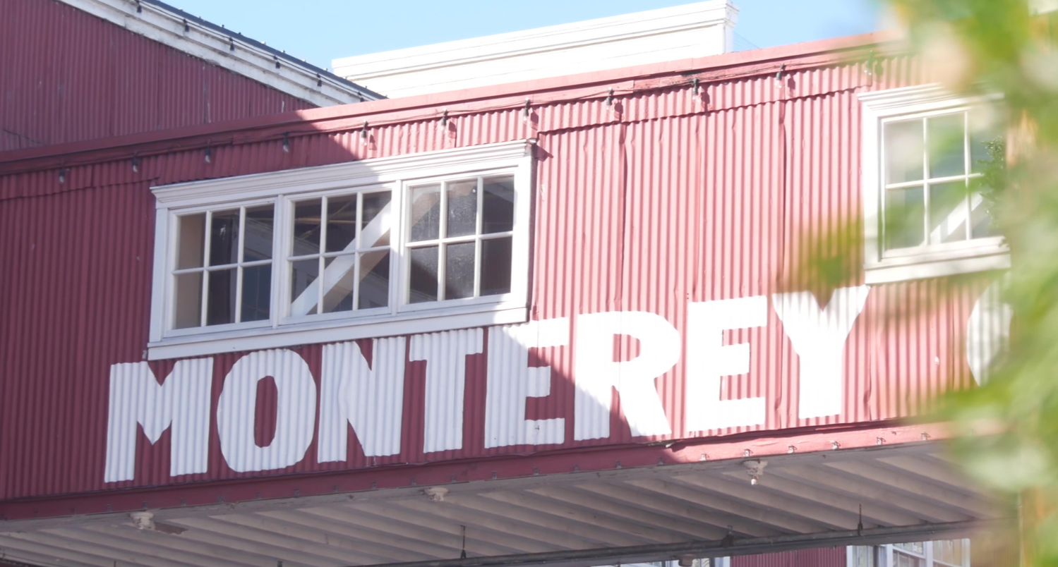
This is the historical center of the Monterey Bay fishing and canning industry, featured in John Steinbeck’s novel, Cannery Row. There are exhibits and dining (seafood, of course!). The Monterey Bay Aquarium is at the far northwestern end of Cannery Row. https://canneryrow.com
Monterey Bay Aquarium
2.8 miles from the Hyatt Regency Hotel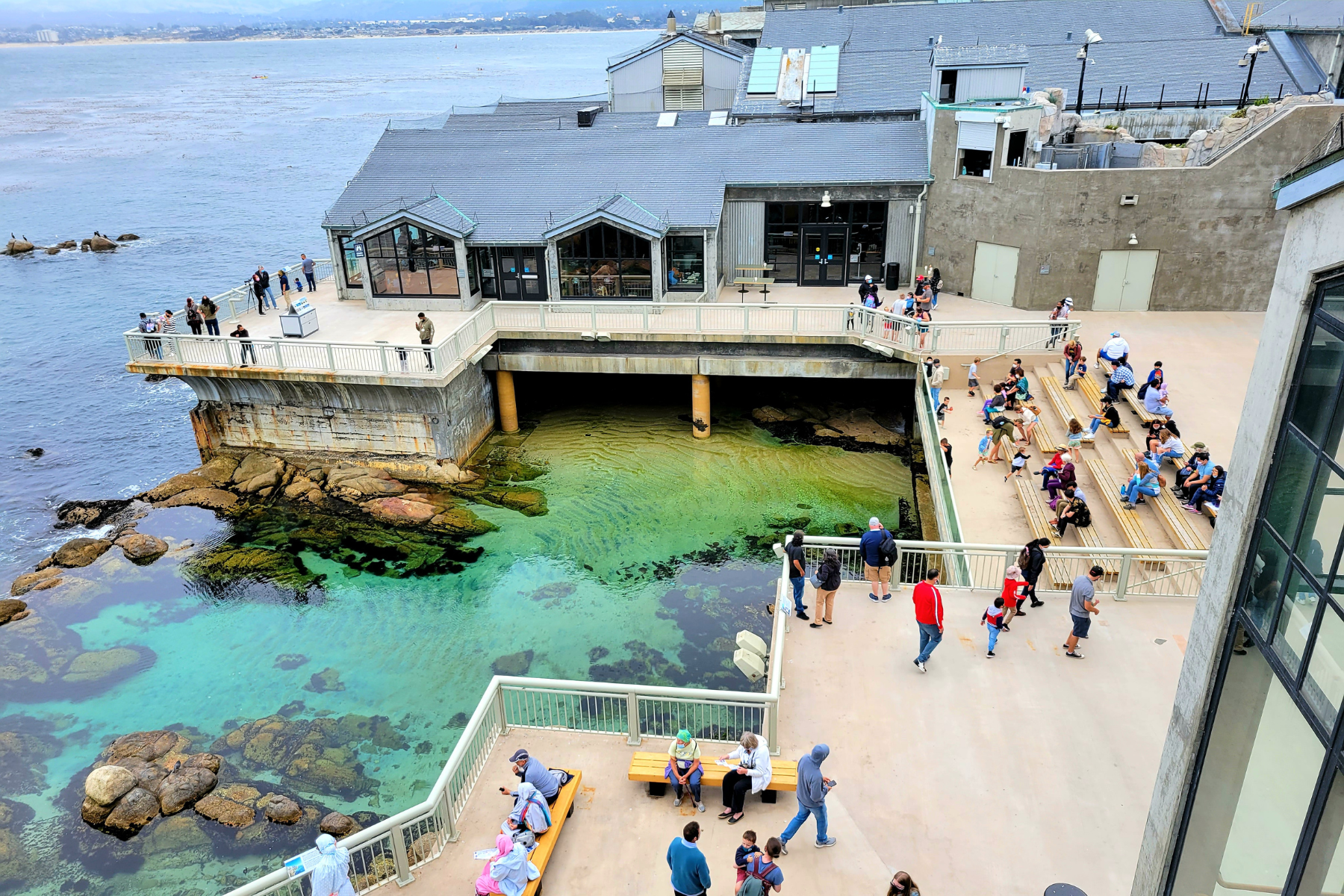
The aquarium showcases the marine life of the Monterey Bay area. Features spectacular exhibits including a large kelp forest, numerous other tanks and galleries, and housing rescued sea otters. 866 Cannery Row. General Admission: $59.95 (Child: $44.95, Youth and Senior: $49.95). https://www.montereybayaquarium.org
Asilomar State Beach
5.1 miles from the Hyatt Regency Hotel 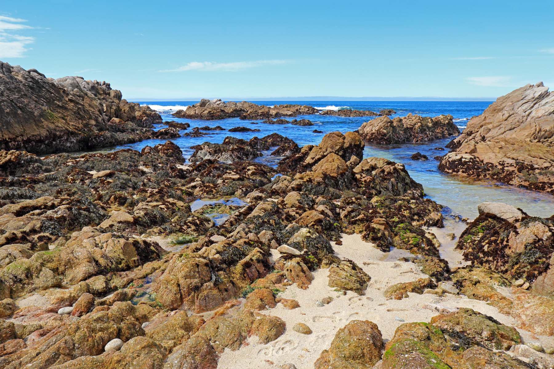
Scenic sandy beach and rocky coastline. Opportunities for walking along the Asilomar Coast Trail (which can also be accessed at numerous points along Sunset Drive) and through the Asilomar Dunes Natural Preserve, showcasing successful native dune habitat restoration. Additionally, the Beach boasts well known tidal pools. 9am-5pm.
https://www.parks.ca.gov/?page_id=566
Point Lobos State Natural Reserve
7.4 miles from the Hyatt Regency Hotel 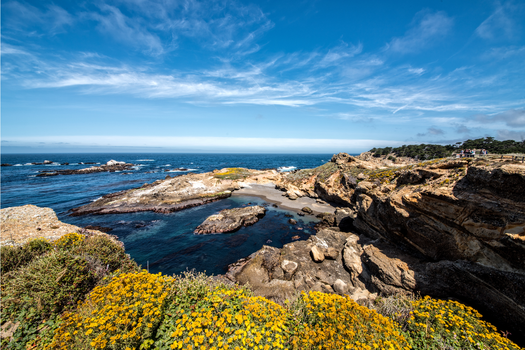
A great place to experience the rugged coastline, picturesque Monterey Cypress trees, tidepools, sea otters, and occasional whales. Walking trails lead to overlooks and through Monterey Cypress groves. $10 entrance fee per vehicle. 8am – 7pm. http://www.parks.ca.gov/?page_id=571
Sea Kayaking at Elkhorn Slough 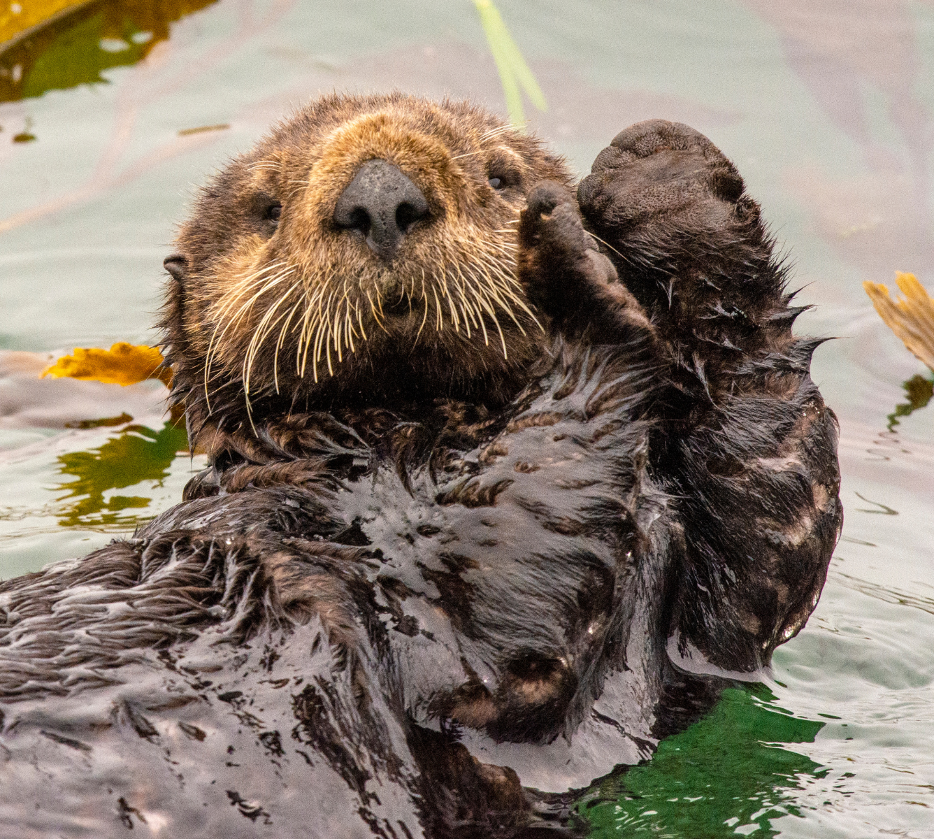
18.5 miles north of the Hyatt Regency Hotel
Multiple companies rent kayaks and/or give kayak tours of various lengths of the Elkhorn Slough, a brackish waterway known for sea otters, harbor seals, and a wide variety of birds.
Recreation Trails
One of the most unique features in Monterey County is the Monterey Bay Coastal Recreation Trail. This paved path stretches 18 miles from Castroville in the north to Pacific Grove in the south. Commuters, residents, and visitors to avoid busy roads, get exercise or enjoy a scenic trip. You can enjoy all Monterey attractions along the waterfront trail, including Fisherman’s Wharf, Cannery Row and the Monterey Bay Aquarium, beaches, parks, historic sites and Downtown Monterey. Several local businesses offer bicycle, kayak, surfboard, paddle board, in-line skate and surrey (canopied quadricycles capable of seating up to six people) rentals along the path.
The trail runs over the old Southern Pacific railroad tracks that serviced Cannery Row during the famed sardine era. The Monterey Peninsula Regional Park District came up with the inspired idea to transform the abandoned lines into a public trail. With aid from the Coastal Conservancy and the cities of Monterey, Pacific Grove and Seaside, the railway transformed into the beautiful and popular trail many enjoy today.
Carmel Valley Wineries
Most of Carmel Valley’s wine tasting rooms, such as Bernardus Winery, Holman Ranch Vineyards and Joullian Vineyards are located just a short stroll from each other, allowing visitors to take a Carmel Valley wine tour on foot. Taste Morgan and Folktale Winery are located along the drive to Carmel Valley Village and is easily accessible. While often lively, Carmel Valley’s tasting rooms are not overly crowded and provide a warm, personal interaction with tasting hosts and winemakers. 
Monterey-Salinas Transit bus 24, the Grapevine Express, stops at all the wineries on this itinerary. It departs from the Monterey Transit Plaza, conveniently located across from the Cooper-Molera Adobe in Old Monterey. Visitors staying in Carmel-by-the-Sea can take the 4 or 22 bus from Mission and Sixth to Taste Morgan at The Crossroads, and from there connect to the Grapevine Express. Check the Monterey-Salinas Transit website for schedules.
Garland Park
Garland Ranch Regional Park is home to a variety of landscapes that occur at elevations from 200 to 2,000 feet. From the willow covered banks of the Carmel River through the cottonwood-sycamore stands of the old floodplain, the trails ascend steeply. Atop the northern crest of the Santa Lucia Mountains, the trails encounter open oak savannas and spectacular vistas. Along the way, you will travel through maple-filled canyons, dense oak woodlands, and thick stands of chaparral. Garzas Creek gently bisects the park and provides a peaceful, shaded trail that reaches a secluded side canyon of redwoods.
The park is also home to a wide variety of insects, birds, plants and animals, descendants of the first residents. Species lists of common birds, mammals, and plants are available at the Visitor Center or the District Museum, both located in the park. 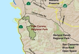
There is a ranger/volunteer staff to help you enjoy your visit. The District provides both in-class environmental education programs and outdoor interpretive hikes and other events for all ages. Day use activities include hiking, photography, horseback riding, jogging, walking, bird watching, painting and simple solitude, and limited mountain bike riding in the Cooper Ranch area. A small visitor center is located at Garland and staffed by volunteers.
700 West Carmel Valley Road (approx 8.6 miles east of Highway 1 or 1 mile west of Laureles Grade)
Palo Corona Park
Palo Corona Regional Park is one of Central Coast California’s most significant undeveloped open spaces. In the largest land conservation project in Monterey county history, The Nature Conservancy, The Big Sur Land Trust, State of California (through several of its agencies), and Monterey Peninsula Regional Park District partnered to acquire the 10,000-acre Palo Corona Ranch. The acquisition was finalized in 2004.
The 10,000-acre ranch was then divided between the State Department of Fish & Game and The Park District to be protected as public conservation and Parkland in perpetuity. The State Department of Fish & Game added the southern 5,500 acres of the former ranch to its existing 640-acre Joshua Creek Ecological Preserve (Preserve). The Park District created the new Palo Corona Regional Park (Park) with the northern 4,350 acres of the former ranch.
In 2018, in partnership with The Trust for Public Land, California Wildlife Conservation Board, California Department of Fish & Wildlife, California State Coastal Conservancy, California Natural Resources Agency and Santa Lucia Conservancy, and additional 190 acres of the former Rancho Canada Golf Course was added to the park, as the Rancho Canada unit. The new unit also contains a Discovery Center and serves as District headquarters. The Park stretches for about 10 miles in length, across more than 4,500 sprawling acres of rugged, spectacular country that boasts an extraordinary mix of ecosystems and wildlife species. The Park established a critical environmental link in a protected seventy-mile long wild land corridor that begins at the Carmel River and extends southward to the Hearst Ranch in San Luis Obispo County. The Park includes the headwaters of thirteen watersheds and protects significant habitat areas, wildlife corridors, wildlife, and endangered species.
From Highway 1, take Carmel Valley Road to Village Park Road (next to Community Church of the Monterey Peninsula). Turn left off Village Park Road to enter the park, where ample parking is available.
Info specific for trail runners
https://www.trailrunproject.com/directory/8012547/monterey